
Geiranger Drone Adventure: Stunning Aerial Views of Norway
Norway is home to some of the most breathtaking landscapes in the world, and on August 9th, 2021, I had the chance to visit two iconic locations: Geiranger and Dalsnibba. Equipped with my Mavic Air 2 drone, I embarked on a Geiranger Drone Adventure, capturing stunning aerial shots of this majestic fjord and the towering peaks that surround it. The weather was partly cloudy, adding depth and drama to my footage.
Exploring Geiranger: Norway’s Jewel
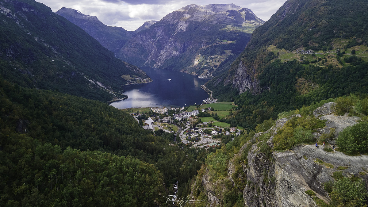
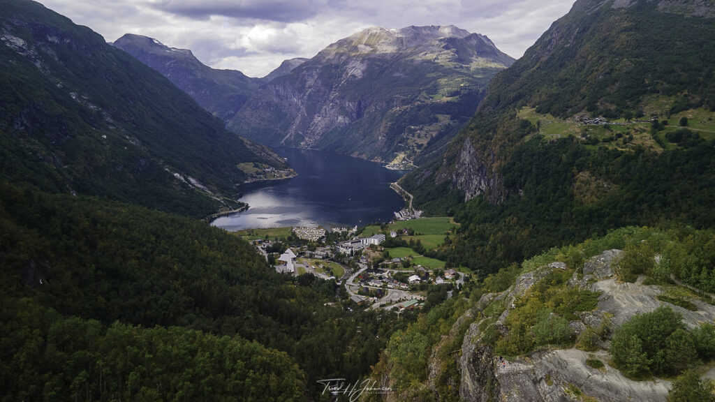
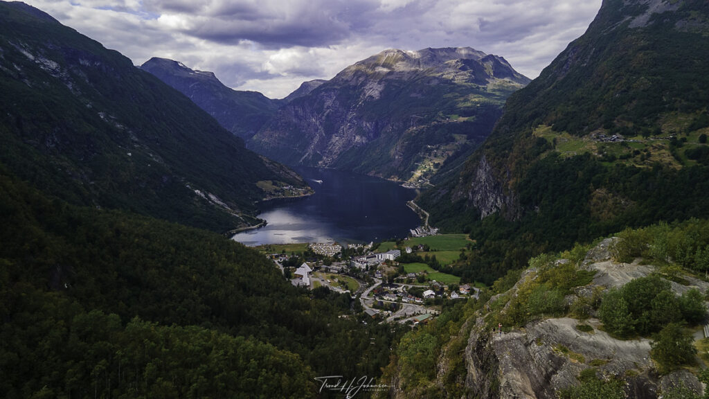
Geiranger Drone Adventure takes you to one of Norway’s most famous fjords. Geiranger, a UNESCO World Heritage Site, is known for its deep blue waters, steep mountain cliffs, and cascading waterfalls like the Seven Sisters and the Suitor. It’s a paradise for nature lovers. The small village of Geiranger, nestled at the end of the fjord, serves as a gateway to this natural wonder.
From above, the drone perspective unveils the sheer scale of the fjord, the winding roads leading up the mountains, and the cruise ships dotting the calm waters. The interplay of sun and clouds on the fjord created mesmerizing light patterns, making this an unforgettable visual experience.
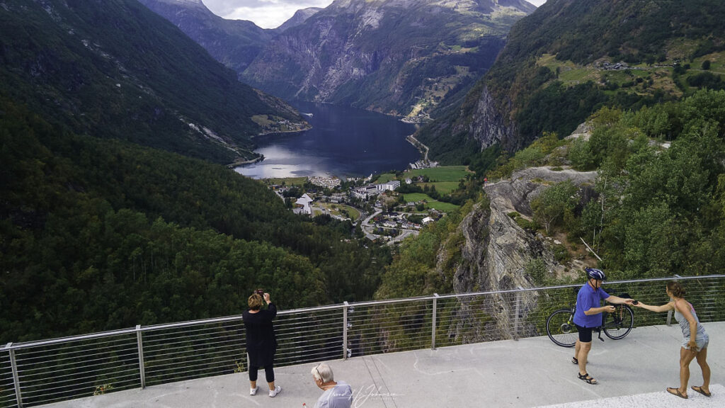
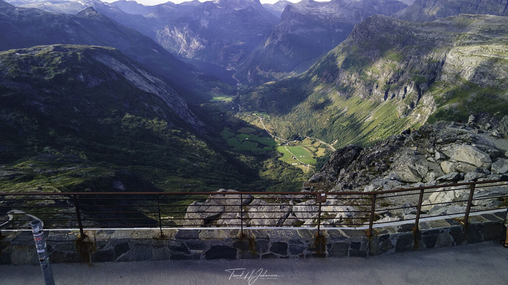
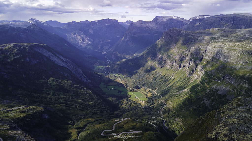
Dalsnibba: A Drone Adventure Above the Clouds
Rising to 1,476 meters (4,843 feet) above sea level, Dalsnibba offers one of the best panoramic views in Norway. The Geiranger Skywalk, a viewing platform at the summit, provides an unobstructed look at Geirangerfjord far below. The journey up the winding roads, including the famous Ørnesvingen (Eagle Road), is an adventure in itself.
With my Mavic Air 2, I captured stunning footage of the fjord from this high vantage point. The shifting clouds rolling over the peaks added an ethereal quality to the shots. The contrast between the deep greens of the mountains, the white snow patches, and the blue fjord was simply breathtaking.
Drone Photography Tips for Geiranger & Dalsnibba
Flying a drone in these areas requires careful planning. Here are some key tips:
- Check Local Regulations: Norway has strict drone laws, especially in UNESCO sites. Always stay updated.
- Weather Awareness: Mountain weather changes rapidly. Ensure your drone is safe from strong winds.
- Respect No-Fly Zones: Avoid flying near crowded areas or disturbing wildlife.
- Golden Hour Flights: Early morning or late afternoon light enhances the landscape’s beauty.
- Battery Management: The cold temperatures at high altitudes can drain batteries quickly. Bring spares.
The Experience of Capturing Norway’s Majesty
Looking back at my Geiranger Drone Adventure, I am reminded of Norway’s raw, untamed beauty. The fjords, with their steep cliffs and deep waters, and the towering mountains above, create a landscape that feels almost otherworldly. Whether you visit by land or take to the skies with a drone, this part of Norway is a must-see for any traveler or photography enthusiast.st.
Geiranger – Location: 62° 5.4085817′ 0″ N 7° 13.3614917′ 0″ E
Geiranger – Location: 62° 5.39585′ 0″ N 7° 13.383′ 0″ E
Geiranger – Location: 62° 5.407215′ 0″ N 7° 13.3683933′ 0″ E

Geiranger – Location: 62° 5.4057983′ 0″ N 7° 13.35648′ 0″ E
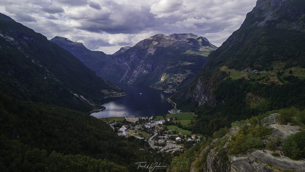
Geiranger – Location: 62° 5.4058717′ 0″ N 7° 13.356505′ 0″ E
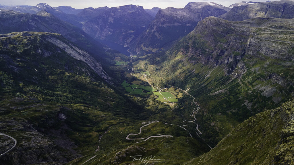
Geiranger / Dalsnibba – Location: 62° 2.9396833′ 0″ N 7° 16.12157′ 0″ E
Geiranger / Dalsnibba – Location: 62° 2.9339867′ 0″ N 7° 16.1654667′ 0″ E
Geiranger / Dalsnibba – Location: 62° 2.9463467′ 0″ N 7° 16.15082′ 0″ E
Location: 62° 5.4057983′ 0″ N 7° 13.35648′ 0″ E